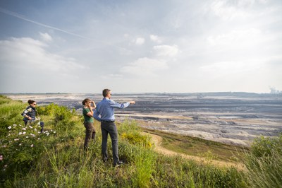
Innovationslabor DG-RR - Digitales Geosystem Rheinisches Revier
Comprehensive information on current conditions, processes and the future development of the geo-ecosystem is needed to drive structural change in the Rhenish mining region. This information is crucial for various sectors such as agriculture, forestry, water management, renewable energy production, spatial planning, engineering and, in particular, the bioeconomy. The InnoLab DG-RR supports the sustainable use of geo- and bioresources such as water, energy and nutrients. It optimises the use of ecosystem services, preserves the functions of ecosystems and strengthens resilience to weather and climate extremes such as drought, heat waves or heavy rainfall in the context of climate change.
As one of a total of 14 research projects in the BioökonomieREVIER innovation cluster, the DG-RR innovation laboratory is funded by the Federal Ministry of Education and Research (BMBF).
The aims of the InnoLab DG-RR
The InnoLab DG-RR contributes to the expansion of the digital geodata infrastructure in the Rhenish mining area. As an interface laboratory and infrastructural platform, it is based on the core competences of the ABC/J geo network. The aim is to enable precise, plot-specific and continuous monitoring, prediction and analysis of all relevant conditions and processes in the geo-ecosystem. The collected data and information are made available as free basic data and (geo)data products, depending on user requirements. For this purpose, a complex geosystem simulation model ("GM-RR") is used, which integrates data from an advanced sensor platform ("SP-RR") and makes it publicly accessible via a data information system ("DAIS-RR") for the general public, business, administrations and other InnoLabs.
How the InnoLab DG-RR contributes to structural change in the region
DG-RR is closely linked to other district nodes, such as "Energy and Industry" and "Digitalisation and Infrastructure". Specific examples of the impact of DG-RR on the structure are:
- Agriculture and forestry: Improved operational decisions, optimised soil management, increased resilience to weather extremes, more efficient use of resources and improved nutrient availability
- Water management, energy production: Predictions of water availability and use, including groundwater recharge, and support for geothermal energy production.
- SMEs: Free availability of new data and products for knowledge-based decisions, business ideas and services
- Engineering companies: Test environment for the development of new, innovative environmental sensor systems and demonstrator for integrated software-hardware solutions.
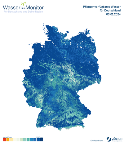
Water monitor for Germany and the region
As part of the development of a multifunctional digital geosystem infrastructure in the Rhenish mining area, the Water Monitor was developed at the Jülich Research Centre. It provides an overview of the soil water balance at a very high spatial resolution of approx. 600 metres for the whole of Germany and neighbouring areas. This makes it possible to predict for a period of up to nine days into the future whether the soil has enough water for the plants or whether additional irrigation is necessary.